Possessing a city, controlling its immediate surroundings and holding a territory with fixed and demarcated boundaries are three distinct realities.
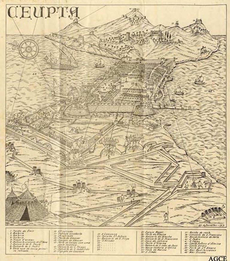
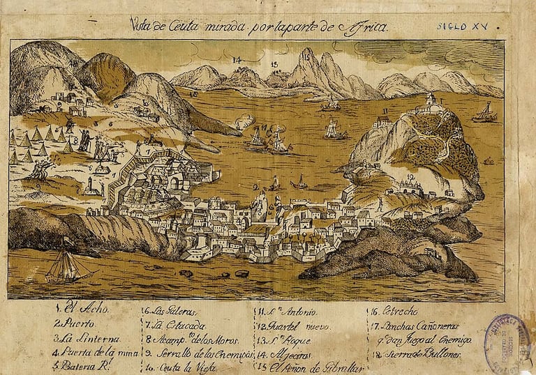
In 1415, Ceuta was a heavily fortified Moroccan city. Its central core occupied the isthmus between the Mediterranean Sea and the bay. Over the centuries, the urban area had developed around the medina into several suburbs, particularly eastward on the Almina peninsula, dominated by the massif of present-day Mount Hacho. To the west of the medina and its outer suburb, al-rabaḍ al-Barrānī (“Arrabal de Afuera” in Spanish historiography), stood the Afrag, the palatial city built in 1328-1329 on the orders of the Marinid Sultan Abu Said.
The Portuguese conquest profoundly altered this geography without erasing it.
Lacking the manpower needed to maintain and defend this vast perimeter, the Portuguese concentrated settlement and defenses around the core of the isthmus. The former suburbs of Almina became depopulated, and part of the peninsula was henceforth devoted to agricultural, religious and military uses, while the Afrag lost its urban function.
The old landward front, however, remained the main axis of defense. Stretching across the isthmus from coast to coast, its walls, towers and gates continued to defend the city’s landward approaches.
The development of artillery soon rendered this defensive system inadequate.
Beginning in 1541, King John III undertook a profound transformation of it in accordance with the principles of bastioned fortification. The new defensive front incorporated part of the medieval structures. The moat was widened and deepened until it formed a navigable canal linking the two bays. A drawbridge provided passage across it and, when raised, severed the only land connection with the continent.
The Murallas Reales also tell us where the fortified city ended.
Beyond them lay lands that remained under Moroccan authority, some of whose heights and plains became the scene of sieges and skirmishes, with positions taken and lost.
For centuries, Ceuta thus remained above all a fortified stronghold.
This logic was particularly evident during Moulay Ismail’s long siege, which began in 1694 and lasted until 1727.
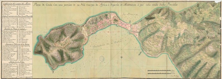
The city remained concentrated within the Plaza, established on the former medina and enclosed between its walls and the sea. Almina was still sparsely populated and largely devoted to farming and livestock, while beyond the fortifications stretched the Campo del Moro, enemy territory on Spanish maps of the period.
Within this area remained the ruins of the former Marinid Afrag. The site and its surroundings regained military importance when Moulay Ismail’s forces established an extensive siege system of camps, entrenchments and batteries.
Under the pressure of bombardments and the influx of troops into the Plaza, part of the population gradually moved into Almina. At the same time, beyond the Murallas Reales, the siege led to a proliferation of defensive works and entrenchments, while forward positions were captured, lost or abandoned as the fighting ebbed and flowed.
Moulay Ismail’s death in 1727 did not bring Moroccan attempts against the stronghold to an end: Sebta was besieged again in 1732, during the reign of Sultan Moulay Abdallah.
A few decades later, the dispute also moved onto diplomatic terrain. Contesting Spanish sovereignty over Ceuta did not remove the need to settle a very practical question: how far did the territory of the stronghold extend?
The question of boundaries appeared explicitly in the 1767 negotiations between Moroccan plenipotentiary Ahmed al-Ghazal and Spanish ambassador Jorge Juan. The Spain of Charles III sought at the time to enlarge the four presidios.
For Ceuta, Madrid put forward specific demands: to push the boundary as far as Serrallo, on the heights well beyond the former Afrag; to reserve an intermediate area for grazing; and to keep Moroccan forces beyond that line.
Sultan Sidi Mohammed ben Abdallah’s refusal was unequivocal.
Article 19 of the treaty enshrined his position. The text provided only for the existing boundaries to be renewed and physically marked with stone boundary markers.
Those boundaries still had to be drawn on the ground. The demarcation envisaged in 1767 did not materialize. It was not until 1782 that a boundary was established, expressly confirmed by the treaty of 1799.
This territorial agreement did not, however, mean relinquishing Ceuta. In 1790-1791, Sultan Moulay Yazid in turn attempted to seize the city and subjected it to another siege. The peace treaty of 1799 subsequently expressly confirmed the territorial provisions agreed in 1782.
It was in the mid-19th century that the question of the boundaries took an entirely different turn.
In 1844, border incidents nearly escalated into war. British mediation helped defuse the crisis. A protocol was concluded on August 25 and, on October 7, a Spanish-Moroccan commission went into the field to restore and demarcate the boundaries. The arrangement was subsequently formalized by the convention signed in Larache on May 6, 1845.
The restored boundary followed the Fez and Cañaveral watercourses along their beds, while a conventional line connected the two across the land. Boundary markers now physically delineated the route so that, in the very words of the demarcation act, there would remain “neither doubt nor cause for dispute.”
But this was not yet the enlargement Spain sought.
The question of territorial expansion remained unresolved until an apparently ordinary border incident changed the situation.
On the night of August 10-11, 1859, members of the Anjra tribe, whose territory bordered the stronghold, destroyed a redoubt that the Spanish had just built as a permanent structure.
The incident could have remained local. Madrid turned it into a matter of national honor.
For Charles-André Julien, this “bellicose reaction,” which produced a “sacred union” in Spain, was officially motivated by the need to avenge the affront. Its excess led the historian to compare it to the famous fly-whisk incident involving the Dey of Algiers.
Spain’s consul general protested in Tangier to the Sultan’s representative, Mohamed Khatib, and demanded that those responsible be punished.
In the meantime, Sultan Moulay Abderrahmane died in Meknes. His son and successor, Mohammed IV, dispatched a plenipotentiary to Tangier in an attempt to resolve the crisis.
This time, British mediation was not enough to halt the escalation.
Madrid soon went beyond demanding redress for the incident: it now demanded the cession of a portion of territory beyond the old frontier.
On October 22, 1859, Spain formally declared war.
Ceuta became the bridgehead for the expedition. Some 20,000 Spanish troops initially landed there before further contingents arrived. Facing them, Moroccan regular and tribal forces attempted to halt their advance under the command of Moulay Abbas, the Sultan’s brother.
Spain’s material and tactical superiority ultimately prevailed.
After establishing a blockade of the ports of Tetouan, Tangier and Larache, the Spanish army occupied Fnideq on December 3, reached the Martil River in January, and then marched on Tetouan. The battle of February 4, 1860, opened the way for the occupation of the city.
Initial negotiations begun a few days later failed in the face of the harsh conditions imposed by Madrid. Fighting resumed and culminated on March 23 with the Battle of Wad-Ras. Negotiations then reopened, resulting in the peace treaty of April 26, whose sixteen articles speak volumes about the balance of power.
Morocco was required to pay Spain a war indemnity of twenty million duros, payable in four installments. Until the sum was paid in full, Tetouan and its territory were to remain occupied by Spanish troops. The burden of this indemnity helped plunge Morocco into a financial crisis with profound consequences.
The treaty also confirmed the provisions adopted the previous year concerning Melilla and granted Spain territory on the Atlantic coast for the establishment of a fishing station at Santa Cruz de Mar Pequeña, whose precise location had yet to be determined.
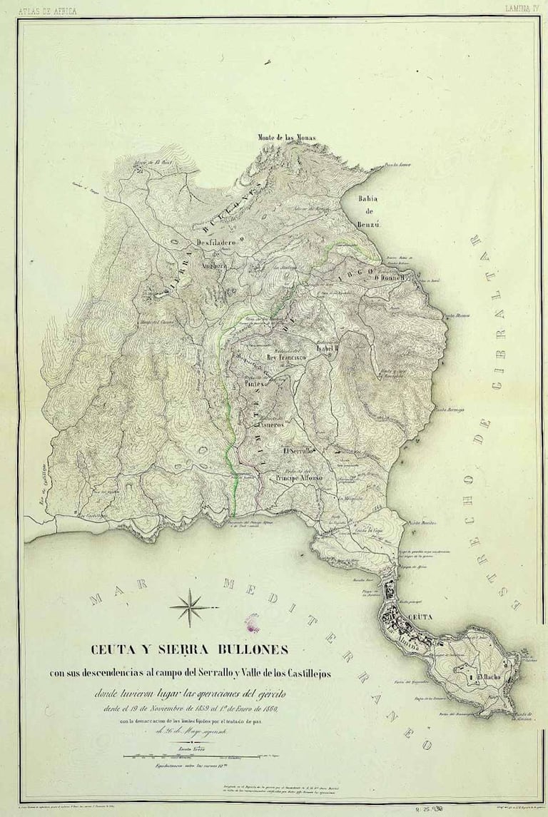
For Ceuta, the treaty enshrined the territorial enlargement in Article 2. Article 3 incorporated the boundary agreed by the Moroccan and Spanish commissioners on April 4, 1860.
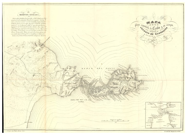
From one sea to the other, the new boundary described an arc west of the stronghold, running along the foothills of the Sierra Bullones and marked by a series of peaks and military positions before reaching the southern coast.
The 1845 frontier, which had followed the Fez and Cañaveral watercourses, thus gave way to a line pushed farther west, onto the high ground overlooking the stronghold. The justification was military: to protect Ceuta from attacks launched from these positions.
A joint commission of Moroccan and Spanish engineers was tasked with marking the route with posts and boundary stones. Beyond this line, the treaty also provided for the establishment of a neutral zone.
This demarcation thus completed a process of territorial construction begun long after the city’s conquest.
The conquest of 1415 and the frontier of 1860 belong to two distinct historical moments. The former was part of Portuguese expansion, strongly marked by the ideology of crusade and the legacy of the Reconquista. The latter emerged from a 19th-century war, against the backdrop of European colonial expansion.
The military works of the 19th century have since been joined by new surveillance and control systems. Today, the border is materialized by kilometers of barriers whose images have become familiar around the world through migration crises.
Seeing them so often, one might imagine that they trace an immemorial boundary. But centuries do not pass from a conquest to a frontier.